

A documentary about the Point Judith Salt Pond



Hear from neighbors
Local residents, aquaculture farmers, historians, and those who work at the Port explain how the pond has shaped their lives.


Laurentide Ice Sheet
The Laurentide Ice Sheet covered millions of square miles over Canada and New England. The artist rendition pictured in the movie was illustrated and licensed by Ryan Anelowe. I came across one of his images online and was struck by the scale of the Ice Sheet that scientists say carved the salt ponds into the landscape leaving behind terminal moraines. When the ice sheet melted, it flooded the coastal plains. Ryan also helped illustrate other map images used in the film.
Narragansett People
The original indigenous people of this land are known as the Narragansett -- the People of the Small Point. The Narragansett dwelled here for thousands of years before European colonists arrived. The film explores the complex relationship between Roger Williams and the Narragansett. Roger Williams is heralded for his belief in religious freedom and the separation of church and state. But his gift to America came at a great price to his "friends" who originally gave him sanctuary. Conquest, the taking of land, and exploitation of resources escalate into King Philip's War.
Estuary Embayment
The Point Judith Salt Pond is a narrow, estuary embayment fed from the fresh water of the Saugatucket River. Fresh and salt water mix, resulting in a brackish environment, a sanctuary for fish and wildlife. The marshland is protected from the full force of the ocean, yet fed by the tides. Naturally occurring breachways encouraged fish migrations and propelled a massive oyster industry until the oysters mysteriously started to disappear in the late 1800s into the turn of the century.
Saugatucket River
The Saugatucket River is an 8-mile long river that flows from North Kingstown and through South Kingstown before emptying into the Point Judith Salt Pond. In the heyday of textile manufacturing, the mills along the river dumped dyes and sewage into the river. This eventually polluted the pond. To this day, shellfishing is prohibited in most areas north of Crown Point. Fish migrations were impacted by the damming of the river and negative effects of polluted runoff from the watershed.
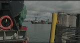
Port of Galilee
Home port to a historic commercial fishing fleet. The port is protect by the Harbour of Refuge - rubble mound structures that protect the permanent breachway into the pond